Aquifers are very old complex subsurface structures that allow water to flow naturally at its own rate.
They often resemble creeks and rivers that flow above ground.
They are not big lakes or pools of water, and they are often stacked one on top of the other with confining layers (clay etc.) in between them.
There are several different types of aquifers - sand, gravels, fractured rock, paleo-channels etc. and at some point, they tend to interconnect with each other, mainly through fractures and fault lines.
So, the trick is knowing where the aquifer boundaries are, where the aquifer fractures are and understand how the aquifers are operating because if you drill a new well you want it to be able to produce good sustainable water.
Your well needs to recharge - if your well cannot recharge it will simply pump out, and in some cases, it can take months to refill, and you do not want that.
An Aquifer Mapping survey will provide you the depth you need to drill to and what you can expect the well to produce.
Without a survey you will never know what aquifers are below the bottom of a drilled well – what has been missed ?
An add on service is mapping the risk of contamination deriving from surface applications. This service provides the information needed to understand where not to apply fertilization product to a farm surface and extends to mapping where natural discharge is occurring into natural river systems.
The Aquifer Mapping information seriously derisks drilling programs and allows careful and sustainable, science-based, long-term management of a very precious and valuable resource and for the permitting process it assists authorities issuing Water Permits to make informed decisions based on science.
Aquifer Mapping has been used to site over 10,000 wells globally and conducted over 200,000 survey points and has crews in Italy, India, Africa, Australia, USA and New Zealand.
Welcome to Aquifer Mapping.
“DRILL ONCE – DRILL RIGHT”


Workflow.
The normal process:
•Interested client contacts Aquifer Mapping. Aquifer Mapping staff hold a conversation with the potential client and the get emailed their property maps.
•Research on the area is undertaken by Aquifer Mapping and followed up with a zero-obligation recommendation and quote for the client to review.
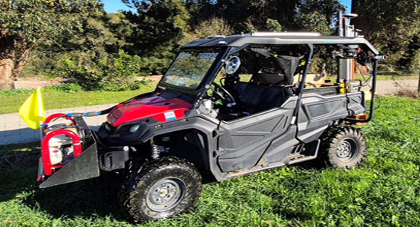
•If a survey proceeds a small ATV bike machine enters the property and moves through at selected areas. This has a very low footprint and is often seen working inside city boundaries and next to livestock.
•The clients field data is recorded, and the electro-seismic field data is then emailed to the Aquifer Mapping data processing centre. From there it is processed and full 2D and or 3D interactive models are built and sent back (normally overnight).
•The models will show any aquifers under the surveyed site to an agreed depth and will follow through to show where to drill a new well, including reasoning on why to drill, how deep to drill, and what flow rates can you expect to extract. Should the preferential drill site not be suitable for the client the report will include the next 3 preferred drilling locations.
•The Aquifer Mapping models are presented in a highly interactive, user-friendly HTML format that is created with the assistance of A.I.
•That information is valuable when applying for an RMA Water permit and provides the client clear peace of mind.
•Aquifer Mappings success rate is 87% globally on striking predicted aquifers, obtaining predicted flow rates and hitting geology boundaries - so - there is still risk but the service significantly reduces drilling blind and assists avoiding the fate and significant loss of dry wells.
Workflow.

Quote:
“Cost is forgotten when you have an excellent water supply…”
“DRILL ONCE – DRILL RIGHT”
Example: This is a typical aquifer shown in green. The blue vertical images are the data acquisition points.
Note: if you had drilled on 60% of these data points you would have totally missed the aquifer and had a dry well…..
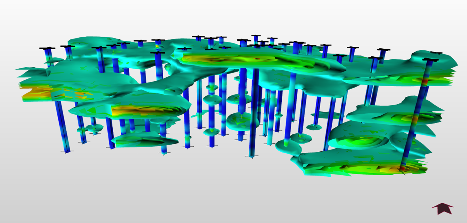

Example: 3D model showing 4 different aquifers - Hamilton Fieldays site - estimated volume of water in each aquifer.
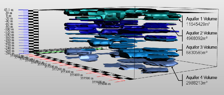
“Manage “your” aquifer sustainably”
This is an example of part of a 3D report.
“DRILL ONCE – DRILL RIGHT”
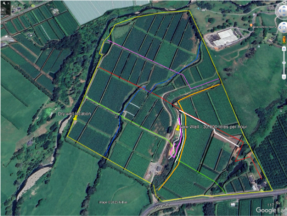
Comments from one of the Aquifer Mapping clients on a large-scale orchard operation in the Bay of Plenty.
“Our orchards medium term focus is to become less reliant on a river water that we were currently using for irrigation & frost protection. Due to population density increase upstream, our ability to take water from the river was increasingly becoming constrained. There were also risks around water quality at key periods that we were looking to mitigate. After spending a significant sum to drill our first bore in a “logical” spot we yielded water that was low volume, low quality and less than ideal temperatures. Because of the significant investment in drilling each bore due to local geology and a number of neighbours that had encountered similar issues, the decision was taken to invest in sophisticated science to identify the most likely next drilling location. Aquifer Mapping was engaged to complete this work for us. They completed this for us in a very timely fashion and identified several high potential sites. After completing a review of these sites, relative to other infrastructure, a second bore was drilled. Very pleased to say that the Aquifer Mapping well yielded excellent quality water at flow rates greater than other bores in the area.
In short it is an investment that should be completed prior to drilling the first well in future!”
“DRILL ONCE – DRILL RIGHT”