We can provide temperature estimations of fluids and reservoirs.
Subsurface water storage
We are also providing a service where we locate map and model areas suitable for injection and storage of water thus avoiding the need for dams and loss of water through evaporation.
4D aquifer and liquefaction monitoring
We are deploying the world’s first stationary suite of monitoring devices that mesh up and provide clear imagery on what is happening in multiple aquifers and areas of liquefaction. More to come on this.
Contamination
We also map and model contaminated aquifers.
Some examples of contamination are iron, nitrates, saltwater intrusion, and hydrocarbons.
CO2 Injection
We are also active in the Co2 injection/storage space and are about to start a project mapping and monitoring the moisture levels in peat here in New Zealand. Peat is a major co2 carbon sink and if it dries out it will release massive amounts of co2.
FREQUENTLY ASKED QUESTIONS
MAP
We locate, map and 3D model aquifers using our electro-seismic technology
Clients
Our client base extends from Governments, farmers, drilling contractors, orchardists, councils, water traders, miners and people wanting new water wells drilled. All clients are looking to reduce risk and understand their aquifer assets and then manage those accordingly.
Environmental management
Good aquifer stewardship and environmental management is having a clear understanding of ground water resources so providing this is also a major part of our business
How do my aquifers work?
The models show how the aquifers are connected to each other, and, how they are connected to the ground surface areas. So the models show where the aquifers are recharging with rain or snow melt and also where not to spray effluent or over apply nitrogen on a dairy unit.
Direction of water
We show the direction and speed of the water flowing through the aquifer systems.
Estimated flow rates
We provide a flow rate estimation you could expect if you drill into a selected aquifer.
What type of geology will my driller go through
A virtual well log showing types and depths of geology is supplied.
How long do the results take
Turn around periods are normally 14 working days from field data acquisition to presentation of the survey results.
Are the machines noisy
Our machines are small and have a very low environmental impact and are often used in cities and around livestock.
Who is the Founder
The founder and technical lead of the business is Dr Michael du Preez (PhD Hydrogeology).
Where is the base
We are based in Gisborne New Zealand but have crews operating all over New Zealand and globally.
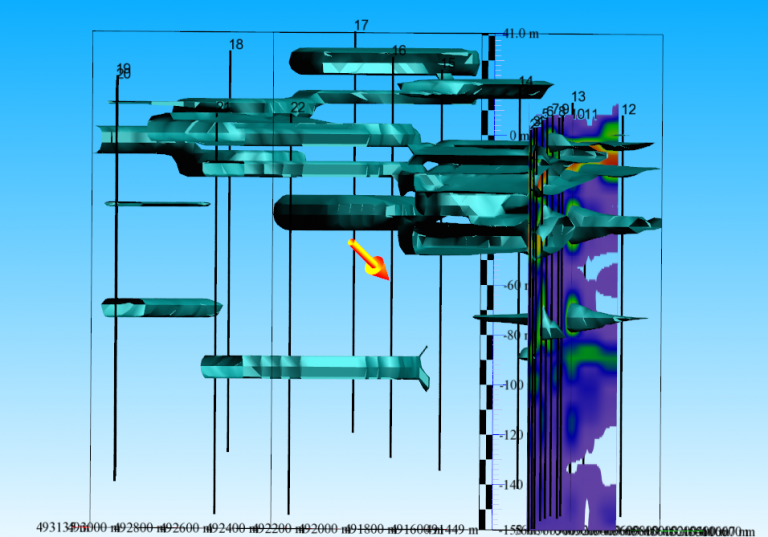
This image is showing the aquifer systems under Havelock North, Hawkes Bay, New Zealand. The dark blue area is showing some high-resolution work done along Brookvale Road where there are wells located. Upon close inspection you can see how the aquifers are connected.
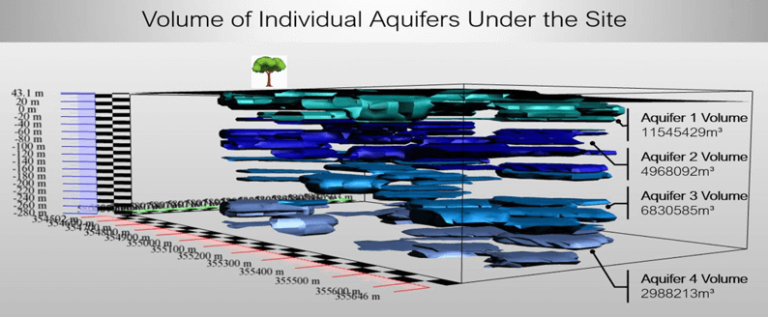
This image is showing 4 different aquifer systems.
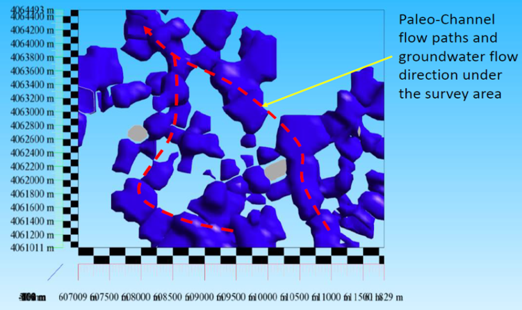
This image is an aerial view of a 700m deep aquifer in California. It is showing how the aquifer has formed flow channels over millions of years. The surface area of this survey is 1000 acres.
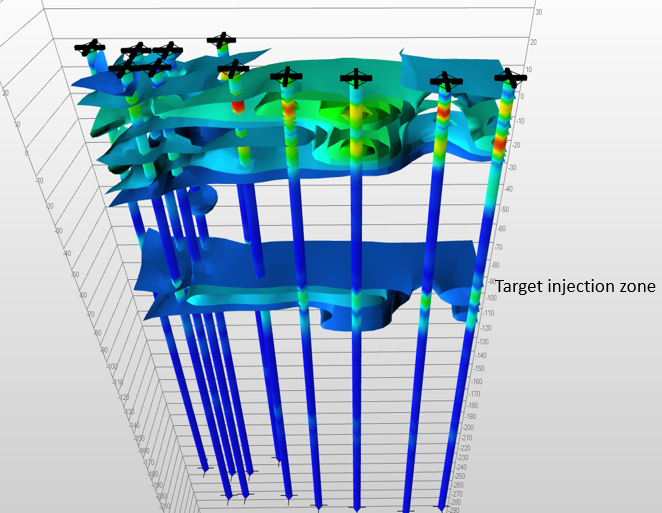
Below ground water storage. This image is showing a deeper permeable confined zone that is suitable to inject and store water (avoids building dams and water loss from evaporation).
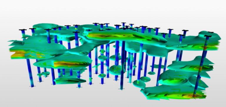
This image is showing how complex aquifer systems are. The blue lines are showing our electro-seismic lines. The green image is the aquifer. Aquifers are not big pools of water under the ground.